eclipse trips
-
Let's just agree to disagree.
Would we get lucky in Kentucky? That was the question. On Friday the cloud
models were mixed. I still remember the disappoin...
2 weeks ago
Adventures & travels of Sultan ~ serotonin by way of sultonic serendipity
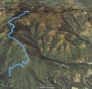
 The Smokies is always a great place to visit, and running the section of the AT from Clingmans Dome to Davenport Gap I have only done once before. The weather was warmer than last and I started in temperatures just under 80 degrees only to get warmer for the next few hours. This is very warm for the Smokies. I walked up the half mile paved path to the summit of Clingmans and headed Northeast on the AT. I started at 9:05am. With in a few minutes I ran into a group of volunteers working on the trail. This would happened a dozen more times as they were working on the entire section I was running. What a great way to give back to something you cherish.
 I started this hike/run with 8 other people. 7 of which were attempting to hike 24 miles. 4 from Newfound gap to Cosby Campgrounds, 3 from Cosby Campgrounds to Newfound gap, 1 was attempting from Newfound gap to Davenport gap (31 miles), and I was going from Clingmans to Davenport gap (37 miles). The logistics were a little tricky, but with a few that volunteered to hike in the opposite direction, and with a car drop, we were on our way to a well planned adventure. The group of 7 hikers had started 1 to 2 hours before me from Newfound gap or from Cosby, and I was 7 miles away from where they were starting. I eventually reached them at Pecks Shelter which is where I needed to refuel and refill water (4:45pm).
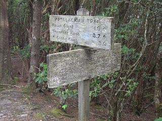
 For future reference, I don’t recommend filling up water from this shelter, it’s almost a mile off the trail round trip. Fill up at Tricorners which is much easier and faster to get to. I spent about 40 min eating my turkey sandwich I brought along, and filling up all 4 liters again, hiking up and down to the spring. I wanted to keep moving because I still had another 20 miles to go, I wasn’t even half way!
 weight was something I felt in my legs. We started on the Connelly Cove trail which descends into the gorge and crosses a bridge. The vegitation was thick and was growing fast. If I was hiking down the gorge this way again, I wouldnt wear shorts. My legs got chewed up. From there we ascended the Little Table Rock trail which is steep. The weather was warmer than I have been used to this year. The breeze was refreshing at the summit of Table Rock. Here we had lunch and enjoyed the beautiful weather and views.
  We then descended back down to the river and swam in the water which felt perfect. Hiking back up to the car I walked past a loose rock and fell over a steep ledge. Luckily a sturdy tree branch caught me and prevented me from falling further down. Other than a few scrapes I was good to go. The fact that I have been running more than hiking with weight was evident in my speed and ability. I will be focusing more on pack training and starting to do more heavy weight hiking to better prepare myself for Mt. Elbrus.
 never gets boring. The weather at the top was 53 degrees about 20 degrees cooler than the campground. We lost about 5 degrees every 1,000 feet of elevation gain. On the return I lied in the South Toe river to cool off.