Warning: the following words and images will allow you to vicariously see the world with the eyes of Sultan. Read at your own risk. The name Sultan has many meanings, but derives from the peak Sultan Mountain in Silverton, CO!


Monday, April 30, 2012

SCAR part duex

SCAR from Fontana to Davenport
Start time: 7:28pm 4.27.12
Finish time: 8:21pm 4.28.12
Total time: 24:53:53
Difficulty: Hard as hell
Elevation Gain: 18,000+
Mileage: 73 Miles

I was dropped of at Davenport Gap on the AT at the Northeastern boundary of the park.  There was daylight left in the day, and I made it about 5 miles before it became pitch black.  The lights of Gatlinburg illuminated the sky. I once again found myself staring at the moon and thinking about the word lunacy while speed-hiking the AT.  I was focused, and wanted to finish the distance of the SCAR, the smokies challenge adventure run in the opposite direction of my first completion of it in 2009.  I passed all the shelters feeling great, and made my way up to Newfound Gap.

As I approached Icewaters Springs Shelter a few miles before the road, I stumbled in a sleepwalking shuffle when my senses alarmed me and I immediately became hyper alert.  I stopped in my tracks when I saw a large animal cross the trail 70 feet from my position, while simultaneously heard a snort.  I wanted to pinch myself to wake up, but I was awake, and my body was sensing danger.  I began to back up when I heard a growl to my rear.  I feared to shine a light at any animal ahead of my or behind me at this 4th hour of the night, so I moved forward on the trail in a fast walk.  As I passed, I saw fresh bear tracks in the mud, they were unmistakable.  My heart pounded, and I kept moving forward hoping that nothing would follow me, and nothing did.  It was 5:15am when I crossed into Newfound Gap.

I pushed on uphill towards Clingmans Dome.  This may have been the hardest part for me, as I was still in a sleeping stooper and was thoroughly exhausted.  I dreamt of my drop bag which was dropped off for me at Clingmans Dome at 5:30am.  It would take me just under 3 hours to reach Clingmans, depleated, hungrey, and in search of more salt I searched for my drop bag.  High and low, looked to the right, and left.  It was intentionally purple, a Phoenician color of choice, and labeled, but alas, no bag in sight. I had a key to a car that was parked at the parking lot half a mile away.  I thought about walking away from this adventure and calling it a day with 38 miles under my belt.  Whence I got to the car, I ate turkey and cheese, and grabbed an entire chips bag.  I made the call to push thru, so I was off again.

I ran downhill and made my way up and down the ridge, past Silers Bald, and from shelter to shelter passing dozens of thru hikers, the likely culprits of my disappearing drop bag. I dreaded Thunderhead Mountain, and sure enough it was challenging to the point of a slow hike/shuffle.  I pushed on, and made my way to Fontana Damn as it was getting dark finishing at 8:21pm in just under 25 hours.  I was especially happy to have put down another SCAR in the opposite direction only 2 weeks after the Grand Canyon double crossing.

Wednesday, April 25, 2012

Double Crossing in Double Shift

Nine of us made the journey to the land of Abu al-Qurq, more commonly known today as Albuquerque, NM.  It was madA's "birthday" and all of us packed into two cars and drove to Flagstaff for some calories and made it to Mathers Campground before midnight for a freezing temp all out darkness tent setup.

The next morning I fumbled thru my stuff and gathered what I needed to cross the Grand Canyon and back.  I carried food, water, salt, and my camera.  I plan to make a video of my journey whence time allows me to do so.  My mind recently has been occupied by the ridiculousness happening in Syria.  I figured I would try to clear my mind a bit and double cross the canyon.

photo by fenix: eying up the beast
  
We started at 6:45am, the early group was Fenix, Doug, Dennis, Beth, and I.  We started our journey at the South Kiabob Trail (7,200 feet) and it was cold.  I wore a cycling hat over my billed hat to keep the head toasty.  All of us were as happy as could be, its that sensation when you see something as vast and naturally beautiful as the Grand Canyon.  Some of us had crossed it in the past, and some were seeing it for the first time ever.  What an experience.

We were down to the Colorado river in less than 2 hours and met up with the rest of the yahoos around this time.  Action Jackson, Junkis, madA, and Chilli Cheetah.  These guys are always in a hurry, so I let them pass me up while I shuffled at my own pace and took in the views of the Canyon.  I passed Ribbon Falls, knowing fully well that I would regret it as I did in 2006 when I passed it up.  Had it been a little warmer, it would have been unbearable down there, and I would have convinced myself to splash around in the falls.  But alas, the cool weather made me reason to not get into the water, and I bypassed the falls all together.  It was here that I felt my stomach begin to churn.  Normally I would ignore this and keep running and let my stomach work itself out.  I knew I could think of 20 reasons for not feeling good as my strength of running and conditioning has deteriorated a bit, but I ignored my mind and focused on climbing up to 8,200 to the North Rim.  After passing Cottonwood I pushed on uphill and ran out of water a few hours up.  I wasn't expecting that, because I knew that there was no water up on the North Rim.  I began to eat snow, and put more snow in my running bottles to try and generate some hydration.  Running out of water or getting lost are likely to best way to perish out here.  So I tried to get my mind to focus and ignore the rational arguments being presented to me in my head.  I set a hard cutoff time of 1pm to summit the North Rim.

Dennis, Doug, and Beth passed me about this point, and they reached the North Rim 5 or so minutes before I did.  I was there by 1:05pm, and depleted.  Not really knowing how I would go back and re-trace my path to Phantom Ranch, and back up the longer less steep Bright Angle trail was something I wasn't going to worry about just yet.  I managed a photo up there, and descended down with Beth, Doug, and Dennis.  Fenix and the fast crew were now hours ahead.

Struggling to run even downhill at times, I tried to keep up with the group, but knew I would evenly run my own pace and get this done.  Again, I crossed Cottonwood Camp and let the group go as I hiked much of this section.

photo by beth: awesome photo!

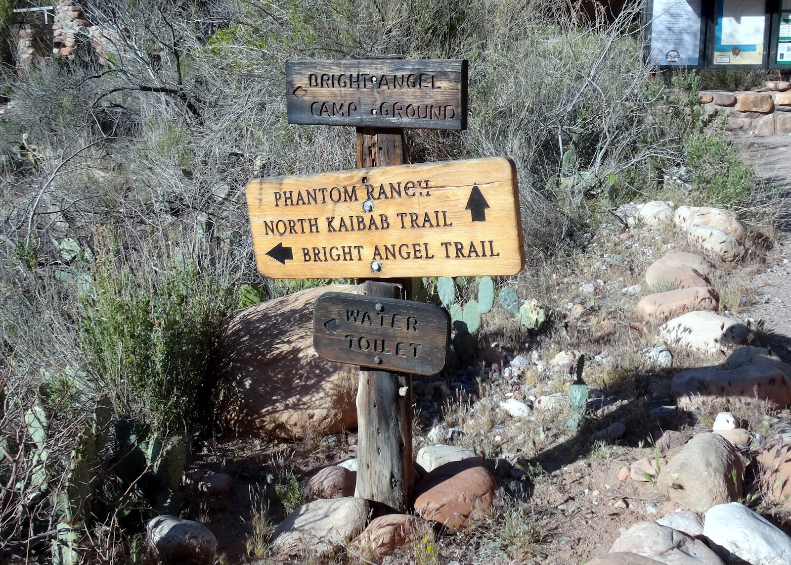
I made it to Phantom Ranch just before 5pm, and I looked at the bright sun angling low in the horizon.  Phantom Ranch is on the North side of the Colorado River and sits at 2,460 feet.  I still had another 9.3 miles to go and 4,300 feet of climbing to get to the South Rim (6,800 feet).  I knew I would be putting in a double shift on this run, and just wanted to make it out before 10pm at this point.  5 hours to the top is a slow shuffle hiking pace.  The sun-setting made for a beautiful journey up to Indian Gardens which is where it got dark.  The rest of the hike was pitch black on very steep sharp drop off switchback trails.  I just didn't want to sleep walk off the side of one of those, so I kept pinching myself until I reunited with the team at the restaurant on the South Rim.  Total time was 15:09 mines.  Amazing adventures, amazing view, with amazing friends.


Sunday, April 08, 2012

Underwater Adventures in the Gulf Coast


So it was my first attempt at scuba diving ever, and it took place in the waters of Panama City Beach, FL.  Of course I had to run a few miles just to calm myself down, this happens anytime I am on a trip anywhere, so business as usual.  My brother Ozmin has been hounding me for years to join him on his adventures underwater, and so I heeded to his call. Scuba stands for Self-Contained Underwater Breathing Apparatus simply because scuba diving involves using a self-contained underwater breathing apparatus (an air tank and 2 stage regulator system) to allow you to breathe air underwater.


I had to go thru what I anticipated being a dull class of learning what I initially thought was as simple as oxygen tanks allowing you to breath under water. My mind wandered until my attention perked when we began discussing atmospheric pressure, and how for every 10 meters of water submersion, your body will experience an additional strain of another atmospheric pressure.  So when under water by 10 meters you have 2 units of atmospheric pressure on your body, most noticeable in your ears and sinus areas, but also in your lungs.  All of which have air in them.  I quickly related the opposite of this to mountaineering, and how thin air acts on the body.  The mix of knowledge enriched the class for me.  The instructor, Todd, was very well informed on scuba diving.  I also checked off on the Nitrox class, which contrary to my initial superficial understanding is more oxygen in the tank, not more nitrogen, the name can be misleading.


This skill set should help me in my adventures to Malaysia this summer when exploring the waters of the Island of Borneo.  Now that I have decompressed from all that pressure, I plan to head off to the Grand Canyon for some running in the snow on the South Rim, down to the Colorado River, and back up to the North Rim snow, only to descend back to the Colorado at Phantom Ranch, send off a few post cards, and then back up to the South Rim for a double crossing attempt. 

Wednesday, March 14, 2012

48M Backpacking in the Smokies

Got off to a late start Friday, and hit the trail by 6pm at Newfound Gap heading Southbound on the AT.  A couple of friends had started early Friday and enjoyed the beautiful hike down to campsite #28 by way of Miry Ridge.  On my drive up, I assumed I would just park my car at the Clingmans Dome parking lot and shoot down to the camp site with maybe an hour or two in the dark.  How naive shall I say?

Without hesitation, I passed the locked gate to Clingmans Dome and parked my car at Newfound Gap, made sure I had an extra set of batteries and took off.  It was going to be dark and cold, and for a more than a few hours.  I passed a few people hiking down and calling it a night.  They were confused as to where I was going at this late hour.  Watching the sun go down in the Pigeon Forge Valley was special.  I caught it on camera, to share with all of you.

By the time I reached Clingmans Dome, it was completely dark, icy, super windy, and frigid.  I was all alone, standing on top of this man made spiral tower, just before 9pm in complete darkness.  Snapped a photo, and kept running.  I made my way past Double Springs Shelter.  A few people in the shelter were concerned at the moving noise with a headlamp, but I just kept trotting thru.  It was a little warmer now.  I pushed past Silers Bald Shelter. This area reminded me very much of our SCAR run in 2009.  Those were the days!

I pulled right onto Miry Ridge, and the Full moon was out and above all the surrounding peaks here.  I could tell this ridge would be more amazing in full sunlight, than in the darkness I witnessed.  You can see the lights of Gaitlinburg and Pigeon Forge clearly from this vantage point.  The single track was nice.  I pulled into camp at 12:30am.

After breakfast, we were off by 9:30am to campsite 30.  We took Middle Prong up to Panther Creek, past campsite 27, and right onto Cucumber Gap.  This section between Panther Creek and Cucumber Gap is filled with swimming holes, creek crossings, and waterfalls which would make great summer time short hikes!  We passed campsite 24 all the way to campsite 30 which seemed to be an island of sorts.  Creeks criss crossed rivers to carve this campsite out.  We moved at a casual pace and made it here in 6.5 hours, 15 miles.

The following morning I hit the trail at 8am.  Wanting to make it home at a decent hour, I took off solo and moved uphill faster than a casual pace.  The sun was shining directly at me when I hit Rough Ridge and Sugarland.  The views here were spectacular.  A few trees blown down made for some interesting side excursions.  I made it back up to the ridge on the AT and ran down to the car at Newfound Gap.  This is where I met Godspeed aka Mark Booth.  He asked me if I needed a cold drink, or a ride down to Gatlinburg to restock.  I smiled, and knew he was trying to help out thru hikers.  I thanked him for his kindness, and struck up a conversation on his AT thru hike with his 18 year old son.  What an inspirational story.

I also made a video, hope you enjoy.

Saturday, February 25, 2012

Mt. Mitchell Challenge 2012

Black Mountain, NC
Distance: 40 Miles
Elevation gain: 4,324 ft.
Time: 7:03:38!
results
photos

Last year I had a difficult run, and finished just over 8 hours.  This year, in not much better shape, I was determined to focus mentally and push myself harder.  I rode up to the hills in dark clouds, and pouring rain, which was then broken up by the winter sunshine.  I picked up my packet from town, and made a dash to the chez Wells for some Italian, pizza, topped off with some burghul, and baklava (not to be confused for a balaclava).  Tim Weed knew the baklava would fuel his body the next day, and loaded up on this special sultonic fuel.


We were off by 7am the next morning, with temperatures in the upper 20's at the start.  Jay called out that temperatures at the summit were 9 degrees with 50 mph gusts.  I immediately thought about our winter RAM traverse only a few weeks back and smiled. 

A few miles into the run, I questioned myself, was I carrying too much gear?  I knew I wasn't, by my mind was still speaking to me.  So I shed a layer, and still began to sweat while running and power hiking up the trail.  I saw Mad A with a classic frozen beard near Sourwood Gap five miles into the run.  There I received my first trail report that Tim and Scott were battling it from the start.  Nothing like a little competition to motivate even a midpack runner.

(frozen coke at a lower aid station)

The sun was out and about on the lower mountain sporadically, and I began to doubt the bitter cold we would face higher up again, but knew that the mountain would brutal.  So I pushed on, and reached the parkway in 2:34.  I knew the wind would be blowing in the more exposed areas, so I threw on my houdini which was now partially frozen and wet.  I didnt care, another layer would be required here.  I pulled my buff around my mouth and put my hat on, to make a adjustable balaclava and protect my face from the cold wind.


We turned onto the Buncome horse trail, where a volunteer mentioned it was 15 degrees, and he looked cold with his down jacket on. I ran with Beth here, where we ran/hiked most of the way to Commissary Ridge.  One section here was fully exposed and the wind really zapped you. 

The hike up Commissary Ridge is one of my favorites, and I may have done it 100 times before.  Surprisingly, it was less icy than I expected.  I've seen it much worse in late February.  We made a push for the summit, and Beth pulled off a celebratory dance.  Risking frostbite to get in this footage, I asked myself why I had my camera with me on the race?  I made it to the summit in 4:05.  Scott and Paul would be finishing up their run within the hour, while I stood on the summit of Mitchell (6,684 ft.) the highest point East of the Rockies.

From there on out, its mostly downhill.  Beth and I made it back to hwy 128 and then I lost her as I could not pound my legs hard enough on the asphalt.  I pulled back into the parkway aid station, only to realize my bottle cap was frozen on.  I needed water, as I bypassed the last aid station fearing idle time in the cold while refueling.  The gracious volunteers put my bottle in boiling water to get that sucker uncapped, and refilled.  I knew catching Beth at this point would be hard, but it made me push myself. 

I passed at least 10 people going down the rocky trail before arriving in Montreat.  The Challenge is a downhill running strategy.  The difference in time you can make while running uphill, is less than the difference of time you can make up while running downhill.  If your trying to win this race, you need to run fast downhill and uphill.  I was not, but trying to enjoy the tradition. 


I did not know what to expect with the new route, but I was ok with it.  I reached the lake in 6:59 and knew no matter how hard I ran, I would not break 7 hours, so I let go of the gas just a little and crossed the line in 7:03:38 which is a full distance Mitchell Challenge PR.  I did run a 5:39:27 in 2010 when the course was shortened due to the breeze.

Left to Right: Scott (1st place), Paul (2nd place), Tim (3rd place)...you guys need to come up with trail names.

Thank you Damion, Haley, Lindsey, Tim, Mad A for the encouragement and for an awesome weekend.  Thank you to all the volunteers who make this tradition possible, and thank you to the Curwins for putting on a stellar run!

I made a video, hope you enjoy...


Monday, February 20, 2012

Rattle My Heart 50k

I rose in compleate darkness and hit the road by 6 am and witnessed an amazing crescent moon.  There is something to be said about the early morning rides up to the mountains, and how so few people experience dusk. Picked up some caffine and a few sandwiches and rolled to black mountain.


The weather was warm, and the forecast called for even warmer weather.  I dropped my arm warmers, and carried two bottles.  I knew I would have water at Kitsuma, and just before Heartbreak Ridge.

This says it all:


This is the first time I feel good most of the entire run.  Awesome run and amazing weather, and even better company!

Saturday, February 11, 2012

Arctic Roan Ascent

Route: Reverse RAM
Distance: 28 miles
Elevation Gain: 7,500 feet
Time: 9:19
Weather: 9 degrees, 30+mph winds, snowing, arctic
Photos by: Matt Kirk, Charlie Roberts, Sultonic
Video: Matt Kirk


The forecast kept getting worse.  But I knew a winter ascent of the Roan Adventure Marathon was a must do, its been on my list for a while, and I was itching for some climbing.  Wilma, Beth, Charlie, the Kirk and I rolled out of 19E and the AT at 8:40am.  It was snowing and temperatures at the start were just under freezing.  It felt warm, and I thought I was carrying more gear that I needed.
The night before, we decided to camp out at Roan High Knob Shelter.  At 6,285 feet, its the highest shelter on the AT.  We picked a perfect day for the first time experience of being in that shelter, along with 5 other backpackers.  That night we discussed strategy on a winter RAM with possible sever weather and forecasters calling it "arctic!"  After much contemplation, we opted for the early am hike out of the shelter and drive down to 19E vs. starting at Carvers Gap.  We descended down TN143 cautiously in the dark as it was covered in a thin layer of powder.  Ate some breakfast, and pulled into the hardware store where we came up with the idea of wanding the trail on the balds should there be a white out condition.  This would help us with route finding on the return.

I quickly shed a few layers after we started as it felt warmer once we were out of the wind, and in the thick of the trees.  I worked hard to catch up with most of these guys, and thus worked up a sweat, which quickly turned into ice as I climbed up into the higher elevations.  I felt like I was wearing a shirt made out of ice!  I could toerate the temperatures, but knew I would end up with freezer burn if I didnt do something about it. By the time I reached Doll Flats I put on my light weight down jacket.  I knew this wold warm me up fast, but also knew once I put it on it was not coming off.

As we pushed up higher, it got colder and windier.  The wind was leathal on top of Hump Mountain (5,587 ft) with its ridges fully exposed.  The wind was easily 30 mph here, and temps were in the teens if now lower on the way up.  I was a little thrown off with what appeared to be a new section of fence on the AT.  I thought perhaps we took a wrong side trail, so we backtracked a littel in the brutal wind.  The white AT blazes were camoflouged in the snow.  Thru this reshuffle, both Wilma and Beth decided to descend.  This was smart choice, and one I almost made for myself.  Charlie and I decided to retrace back to the AT and keep pushing thru this weather. 
I was happy to reach Bradley Gap and get into the cover of the trees and escape the wind.  I remembered the several days we camped at 17,200 ft. on Denali looking at wind plums higher up on the summit and deciding to take a zero day on what otherwise was a nice balmy.  The wind can kill you at these temperatures, and surley can give you frostbite, frostnip, or windburn.  Covering any exposed skin here is crucial.  I was unable to do this because I lent my balaclava out, which I paid the price for.
We climbed up another hill and passed Little Hump (5,460 ft.), then downhill again all the way to the shelter just before the big climb.  Here I realized I was dehydrated as all my bottles froze, and there was no way to get any hydration.  I thought to myself I should turn around now while I had the chance.  It kept getting colder, and windier.  The weather was not improving.  After a little encouragment from Charlie, we decided to keep pushing, and on we climbed. 
It took forever to climb up to Grassy Ridge Bald (6,189 feet), but I was happy to see a small stream of water trickeling close to the summit.  I knew I would try to refill my bottles on the way down.  Once we were on the balds again, the wind would pick up and freeze up my buff and gloves, and really send a chill to the body.  But the Balds higher up here were less brutal than the Hump Balds, which I have nightmares about now.  We passed the frozen sign that says Janes Bald (5,807 ft.) and pushed on to Round Bald (5,826 ft.) which is where we camp out the night before the summer RAM.  Here we saw the Kirk, who was jovial and moving well.  The sun looked like it wanted to come out here, but it never really did.  It was just before 1pm, and I knew we were close to Carvers Gap.  Matt encouraged us to go the distance, and would catch up with us at the finish.  We made a dash for Carvers Gap, where a few 4 wheel drive rides were hanging out. 
On the return, the weather progressivly got worse.  Charlie clocked 9 degrees on his watch.  I was never able to refil my bottles, and when attempting to do so my gloves got wet and the water froze immediatly in the bottle.  I balled up my hands inside the wet gloves to not let them go numb.  My buff froze on and off, and blowing hot breath onto them did noting.  My ear lobes were exposed to the sever winds on Hump, and both ears are blistered now, but are healing. I feared the balds with the winds, but we made it back, and out alive.  What a winter adventure?  These conditions were by far some of the worst I have seen in Western North Carolina, and its easy to go underprepared.  It goes to show you some of these high peaks can be brutal!


Whoooa?


Wednesday, January 25, 2012

Sultan 50k - 2012 Report

4th Annual Sultan 50k33 Miles - 7:34
South Mountains State Park
Photo's
Results

Top 5 Official Finish times:
1. Adam Hill - 4:14
2. Jeremy Hargroves - 4:47
3. Tim Weed - 5:02
4. Dennis Norris - 5:17
5. Matt Kirk - 5:45


Top 5 Actual Finish Times:
1. Tim Weed - 5:12
2. Adam Hill - 5:14
3. Jeremy Hargroves - 5:22
4. Matt Kirk - 5:55:555
5. Dennis Norris - 6:17


The fourth year we run the Sultan 50k the rains would have their way. The day prior to the run weather reports came back with 70% chance of rain and thunderstorms.  The cake (Thanks Melissa!) was in the fridge, and we were all set to go.  I shuteye well past midnight and made sure I had everything ready for the early morning departure.

We rendezvoused at the Cracker Barrell early, and made the drive up to the Jacob Fork Parking area.  The gate was closed when we arrived, and we waited for a few moments before the ranger drove up and unlocked the gate at 7:50am.  We met up with the rest of the crew at the Subway off of 64 just past 8am, and caravanned over to Roper Hollow Rd. at 9:40am.  Greg, Paul, and I rode up together.

Greg helped me pass out the crowns and check runners in, and Adam volunteered to take off a few minutes early to ribbon up the trail so that the rest of us dont get lost.  Lily offered to shuttle aid from the Start/Finish to the midway aid station once again this year.  Erik, Julie, Bouchra, and Omar made it out to the aid station to help out this year, what a stellar crew!  Charles and Psyche helped out again this year to sweep the coarse.  Thank you all for the help, and braving the rain!

We had over 40 runners sign up, and 28 show up to the start.  I myself had a nasty flu a week and half before the run, and was unsure if I could make my own party on the trail. We took off just after 10am, and began running up Roper hill.  I hung out with Greg for the first part of the run, and then caught up with Paul, Kathleen, and Beth.  It rained most of the way up, and the cloud formations are the same you would see in the Smokey Mountains.  Me and Carl came into the aid station together in 3:03.

The entire crew was out there braving the weather.  Erik and Julie got a small fire started, and by the time I arrived I saw some runners hovering around the fire and were planning to bail on the run.  I myself immediately got cold as I was drenched fully.  I quickly offered up a handstand for some bonus points, and downed some red velvet cake along with some coke to try and replenish my body.  I felt a little dehydrated despite all the rain.  2 bottles never seems to be enough for me.

I hugged loved ones and went on my way. I was freezing, but I knew the steps up to the waterfall would warm me up quickly. Beth and Kathleen rolled out with me to the waterfall, and then I let them go.  My return trip was just as challenging as it was last year, slow and steady. The sun broke out the last half hour, and the view of the Black Mountain Range was in full view.  When I thought I was running the last bend of Ropper Hollow and surely I was done, another 14 bends poped up.  I finished a little faster than last year, but still felt like I could improve tremendously. Finish time was 7:34.

Later we all hit up Jalapeños for dinner for some bonus points!  Thank you to all who made it out for another great year.

Sunday, January 01, 2012

11th ALTAR

distance 30 miles
ALTAR 12.31.2011 - 10:17
photos

What better way to end the year, than to run the Art Loeb Trail, dubbed the ALTAR adventure run!

Many of us gathered at the Vance Lodge at Camp Daniel Boone the night before, and shuttled to the start line early the next morning.  We were 13 runners at the start, and it was warmer than I could remember it ever being on a late December morning at the Davidson River campgrounds.

I had all my cloths on at the start, probably not carrying enough cloths I thought to myself.  After our group photo, we took off, and the clock read 7:04am.  I ran off alone, and set my own pace.  The morning was perfect, and I peeled off most of my layers exposing my hands and arms to the cool crisp air which gave me a refreshing feeling.  The sun rose from the horizon, letting the bright rays filter thru the trees as I propelled my body deeper into the hills.

I often gather my thoughts of the year during this run, take some time to see what I have covered in the year past, all while intermittently thinking about what I have in store for 2012.  I quickly tapped into strong emotion early on in the run, earlier than usual.  I often think I run these distances to get away from the city lights, but I also wonder if I am addicted to tapping into my subconscious mind.  The gates to the subconscious are not easy to open, but today would be a day the doors were wide open.

Many opportunities came and went in 2011, and soo much harm has occurred around the globe this year.  Ill spare all the details, but feel its important to recognize this man, Mohamed Bouazizi, a 26-year-old fruit-and-vegetable seller from Tunisa, who had doused himself in petrol, flicked a lighter and started a revolution in front of the building.  This man caused a viral revolution which kept coming to the surface of my mind.  The trail helped me, especially when I hit pilot mountain.

I climbed slower than I wanted to, it was indicative of my conditioning.  I met up with Scott and Carl here where we ran and hiked together.  Once we reached the top of Pilot we took a small break to soaked up the views.  The weather was stunning, but I knew if I lingered for too long I would get cold.  So I took off down hill.  I found a trickle to fill up my empty water bottles and kept pushing threw.  When I approached the climb after Pilot I felt like stopping.  Knowing this was impossible I kept pushing thru.


As I crossed the parkway I ran into 3 runners who started opposite of us, and then ran into Liz and Boxer, her new dog.  We hiked together thru the balds, and up into the narrows.  I finished this years ALTAR before the sun set, which is always my goal in 10:17.

Awesome run, and great post and pre run shindig by Matt and Lily Kirk!

Friday, November 11, 2011

seven 11's

It was exactly 11 seconds past, 11am, on the 11th month we call November in the year 2011, and I was on a mission to run section 11 of the mountains to sea trail which stretches from NC 181 on the Northwestern section of the Linville Gorge to US-221 just North of Marion, NC.


There were 11 of us, and thirty five miles of trail to cover with over eight thousand feet of elevation gain. This is not your typical Friday morning jog. The elevation gain was plenty, steep, and unmissable while climbing Pinnacle. For those of you that have visited the gorge, the incline (and decline) gradient is unforgiving. Leaves, in some areas a foot or more deep blanketed the trail, making those large rocks, and small boulders attack your ankles by surprise. The sunshine was bright, but the breath was visible for most of the day as temperatures never went north of 45 degrees. Exact location at 11:11:11 on Nov. 11, 2011 was climbing up the backside of Shortoff Mountain.

The expansive views of The Chimney's, a few miles before Shortoff, may have been the highlight of the day.  A massive crater in the earth on the east coast is something that should be experienced by any adventurer out there.

Just past the Shortoff spring,  Tim Weed, passes me.  He took the scenic route up the summit of Table Rock and relished the magnificent views of the day while I pushed forward knowing I would need a bit more time to make it back at a reasonable hour.  We both got carried away and ran towards a structure and a parking area.  I knew immediately we had gone off tail, and yelled out to back track.  Tim has the speed of a gazelle, and and a humbleness that is contagious.  Shortly after our back track, I found myself alone descending deep into the gorge, and finally reaching the Linville River, where I saw Isaiah having lunch.  I knew he would catch up tome, so I opted to cross the river alone (thanks for taking the photo)!

The following climb up Pinnacle was a beast.  Isaiah had caught up to me at this point, and we enjoyed a few moments of calorie intake.  Then off he went in the distance, as I speed hiked the next several miles.  It was another few up and down, crossing the tracks, to finally make it back to US 221.  Finished this one in the dark!

The post run dinner at Jalapenos with friends was a great way to end an amazing day.  Thank you Matt and Lilly for putting on this adventure!

Saturday, October 15, 2011

PITCHELL 2011

Every year I look forward to this run, which I consider a must do in the Southeast. It’s a pilgrimage that pays homage to the valley called Ashevags which starts at the summit of Mt. Pisgah and ends at the summit of Mt. Mitchell. Many of my long trail runs, and memories of mountains come from this part of Western North Carolina, which make this run truely special.

The 67 mile journey is all on mountains to sea trail, so you just have to follow the white dot. Easy right? Every year I have run this, it seems I go off trail. The midnight start always guarantees a drowsy sleep walking runner who might not have all cognitive and sensory abilities at normal levels. This year I opted to start earlier, at 6:30pm with Brian, Terry, and Dave P. I missed out on the Friday night festivities, and the midnight start, coupled with longer night running time, but was something I considered as an advantage for me. I needed time on my side, and wanted to finish this years Pitchell.

April, Dave’s wife, was gracious enough to give us the ride up to Pisgah. We all held our breath when we went thru any tunnels, and made it to the Pisgah parking lot just after 6pm. Terry and I lead the hike up to Pisgah. Once we reached the summit, we all looked at each other and pointed at Mitchell. Godspeed.

My watch read 6:33pm. We took off. I was planning to pace myself thru the night and give myself the best chance for a Mitchell summit the next day. Running down Pisgah as the sun began to set and filtered thru the trees on a cool crisp fall day gave me positive energy which I knew would last thru the entire night.

Earlier this day I was up early for a business meeting. I had not slept enough, nor did I put enough sleep time in the bank. Sleeping over 7 hours a night for several night prior to these types of coyote runs (all nighters) builds a reserve. I knew my reserves would be low, so bought a few starbucks coffee drinks to drop on the trail and help keep my eyelids from shutting.

I turned my headlamp on, I was carrying two, and my fenix light after a few miles. The fenix light I knew would be a life saver here, as the technical tree covered trails makes for a tricky slow descent without the proper output of lumens. In 2009 and 2010 I went off trail before reaching the French Broad river, ultimately leading to a DNF at the FOLK Art Center, this year I was determined to stay on trail.

My pace was slow and steady downhill, just what I wanted. I needed to leave some reserve for the last half of this run. I felt stronger than anticipated and mentally my momentum was building. I reached the FAC at 2:18am, in 7:15 from the summit of Pisgah. This in no way is a fast time, but what I was looking for. I was on target, and feeling good. I was cold however, and needed to add more layers for the next part of this journey. I made rookie mistakes here, I fumbled thru gear and food. I left my car discouraged as I could not find my arm warmers, which I considered to be a critical piece of gear considering conditions. I walked past the FOC and ran back to my car to pillage thru my stuff again, still could not find them. I had wasted more than 40 minutes here looking for gear, changing cloths, hydrating and eating.

Onward I told myself. I did not want to stall here again for a third year. I was tired and and sleepy, and my mindset was easily convinced of how ridiculous this adventure really was. I knew Greg Paige would be around on the parkway this morning, and felt comfortable to push on. My pace slowed as I slept walked parts of the trail when my body would refuse to wake up, all while speed hiking. I somehow went off trail here and ended up at someone’s home or cabin. I realized this when I heard loud barking and saw lights on. I turned around and within 10 minutes found the white dot. When I found the trail, in my state of somniacness I was not sure which was to go as the trail was in the middle of a bend. I turned left which at the time seemed to be the best choice. I later learned of my mistake when I saw the road I crossed just passed the FOC. I cursed gently, and turned around again and found my way back to where I originally made my mistake. More than one hour was lost here. I know had I been fully awake, this would not have happened. I have been on this trail many times before.

I kept pushing onward. I pushed past Cravens Gap, and still in a sleep walk state, saw the gallons of water on the trail. Refilled, and kept hiking. I was out of it, and cold. In the darkness and cold, all while in the sleep deprived state I knew finishing this monster would be hard. Just before I reached Bull Gap as I was crossing a road, I saw an suv with lights on. It was 5 or so in the morning, still dark, who would be out here? I walked over and saw Greg roll down the window with a big smile. I knew getting in the car would be a bad idea, but my body just opened the door and I sat in and blasted the heat. I ate a little, caught up on life with Greg for a few minutes and then passed out. It was well over an hour and half later that I woke up…”whhhaaaaat?” I thought to myself.

I thanked Greg, and mustered up the energy to get out of the car in 41 degree temps. As I got back on the trail to my surprise I see MadA crossing the road. He was a bit out of it. We hiked together, and told him a few jokes hoping this would bring up his spirits. I was having a hard time keeping up with him even after resting for almost two hours. I was cold immediately, and never really was able to get my core to warm up properly. As the grade got steeper up Lane Pinnacle, MadA disappeared in the distance. Moments later Uwharrie pulled up besides me. I have run many miles with Uwharrie and it was good to know some of the other fellas were on my tail, perhaps I would move faster with them. The Grand Kirk and Brian K rolled in and we chatted for 4.7 milliseconds. I reached the summit of Lane Pinnacle, which is incredible this early in the morning. The sunshine made the body of water visible from here glisten like the glaciers of the Central Alaskan Range did. I kept moving. Peircy, and Andrew rolled up behind me and passed. I knew I was toast, and would drop out at the next possible chance.

I crawled into the car at Bee Tree Gap, 51 miles away from the summit of Mt. Pisgah and got a ride back to my car. All in all a great adventure, and one day will have to wrap my mind around this one and make it to the summit of Mitchell.

A huge thanks to Greg for helping out here, to April who gave us the ride, Adam who uncountably works hard to pull all the strings together to make this run happen, and to all the volunteers pre and post run whom without this adventure would be exponentially more difficult.